
Off-Ramp to Nowhere: The History of SR-252
How a planned freeway through the heart of Southcrest was fought, canceled, and what remains today.
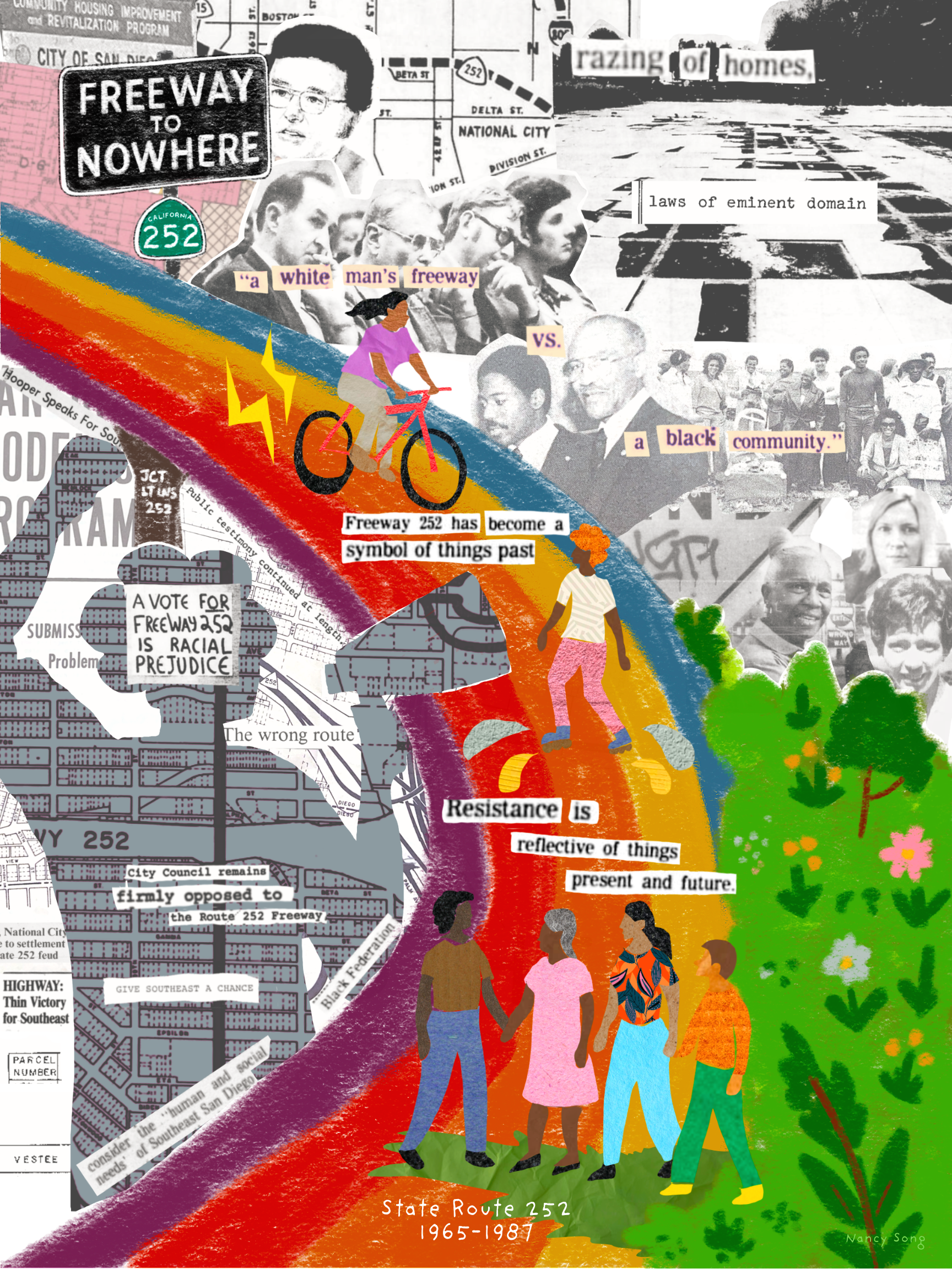
Researched from archival records, oral histories, and primary documents by Nancy Song, UC San Diego, 2025
Brief OverviewThe S 43rd Street Interchange begins and ends abruptly. Its massive concrete ramps curve into the sky, connected on one end to Interstate 805 but leading nowhere. To the casual commuter, it's unremarkable. To longtime residents of Southcrest, it stands as a symbol of what was lost—and what could have been.
PART ONE
A neighborhood built on exclusion
“If San Diego has slums, they are here. If San Diego has a ghetto, it is here. If one sector of the city has fallen behind in the pell-mell race for progress and perfection, it is Southeast San Diego.”
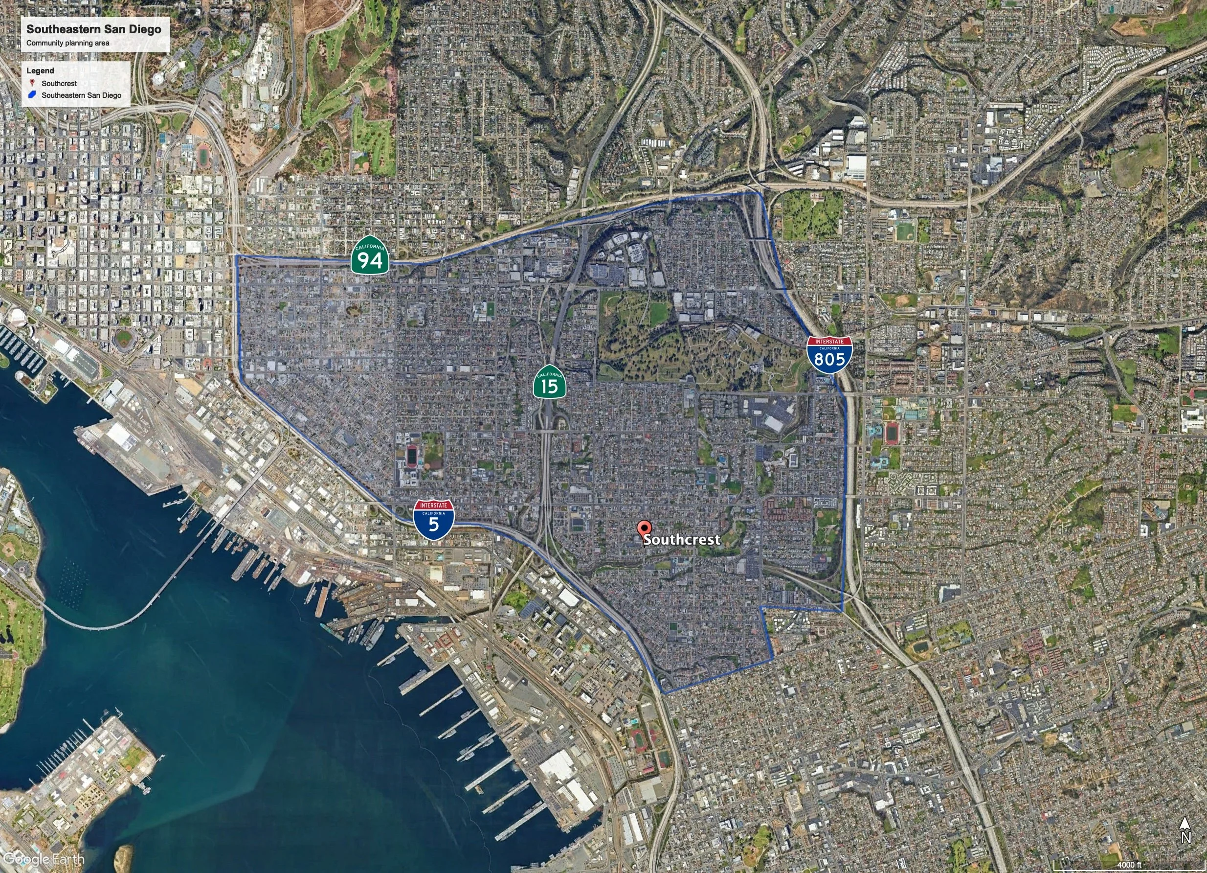
Southcrest's story did not begin with a freeway. Long before SR-252 was drawn on a planning map, the neighborhood had been deliberately shaped by exclusion. In the early 1900s, land speculation and railroad expansion drew working-class residents to Southeastern San Diego. But as affluent white San Diegans gained mobility through the automobile in the 1920s, they moved to new suburbs gated by racially restrictive covenants. Older neighborhoods like Southcrest became, by design, the only viable option for families of color and lower-income residents.
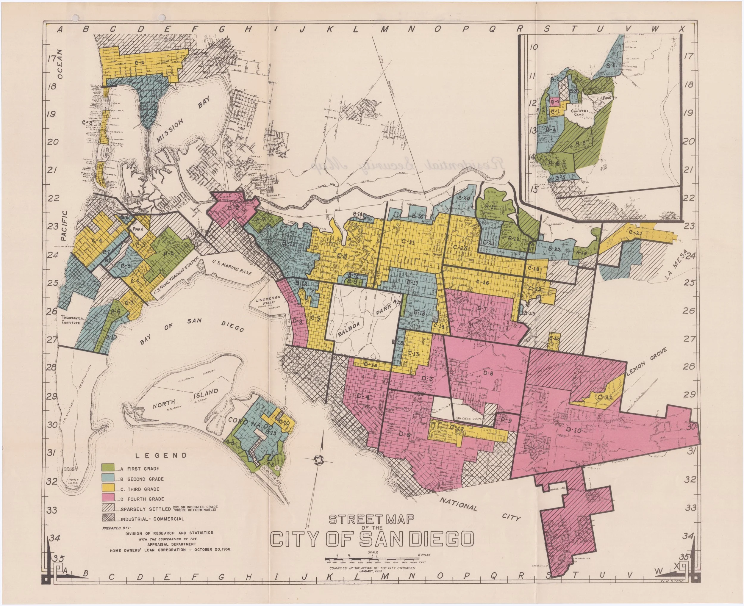
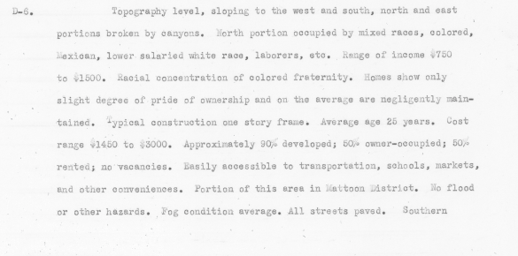
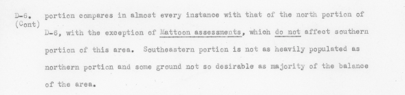
By the 1930s, the federal Home Owners' Loan Corporation (HOLC) had formalized this pattern. San Diego's 1939 residential security map classified Southcrest as Zone D-6, the lowest “hazardous” grade, describing it as a neighborhood of “mixed races, colored, Mexican, [and] lower salaried white race.” This classification denied Black families access to home financing and made Southcrest one of the few places where they could purchase homes or open businesses, but at the cost of being confined to a disinvested, systematically neglected neighborhood.
World War II brought thousands of Black migrants to San Diego through the Second Great Migration, drawn by military and defense industry work. But persistent housing discrimination meant they were steered directly into neighborhoods that had already been redlined. Between 1950 and 1960, the Black population of Census Tract I0036 (encompassing Southcrest) grew from 128 to 2,110 residents. By 1970, it had reached 2,926. The neighborhood had also become predominantly renter-occupied (54.3% of households), with a median household income of just $3,042 — giving fewer residents financial leverage or political standing to resist what was coming.
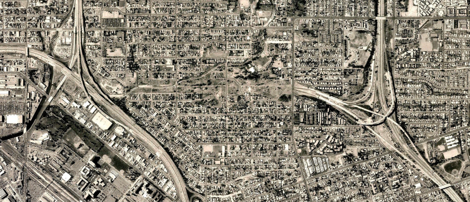
Meanwhile, Southcrest was being physically enclosed. Interstate 5 closed in from the west, State Route 94 from the north, and Interstate 805 from the east by the late 1960s. The community was boxed in by infrastructure before SR-252 was ever proposed. As one 1972 San Diego Union-Tribune article put it, Southeast San Diego was “a jumble of decaying houses, freeways, junkyards and perplexities.”
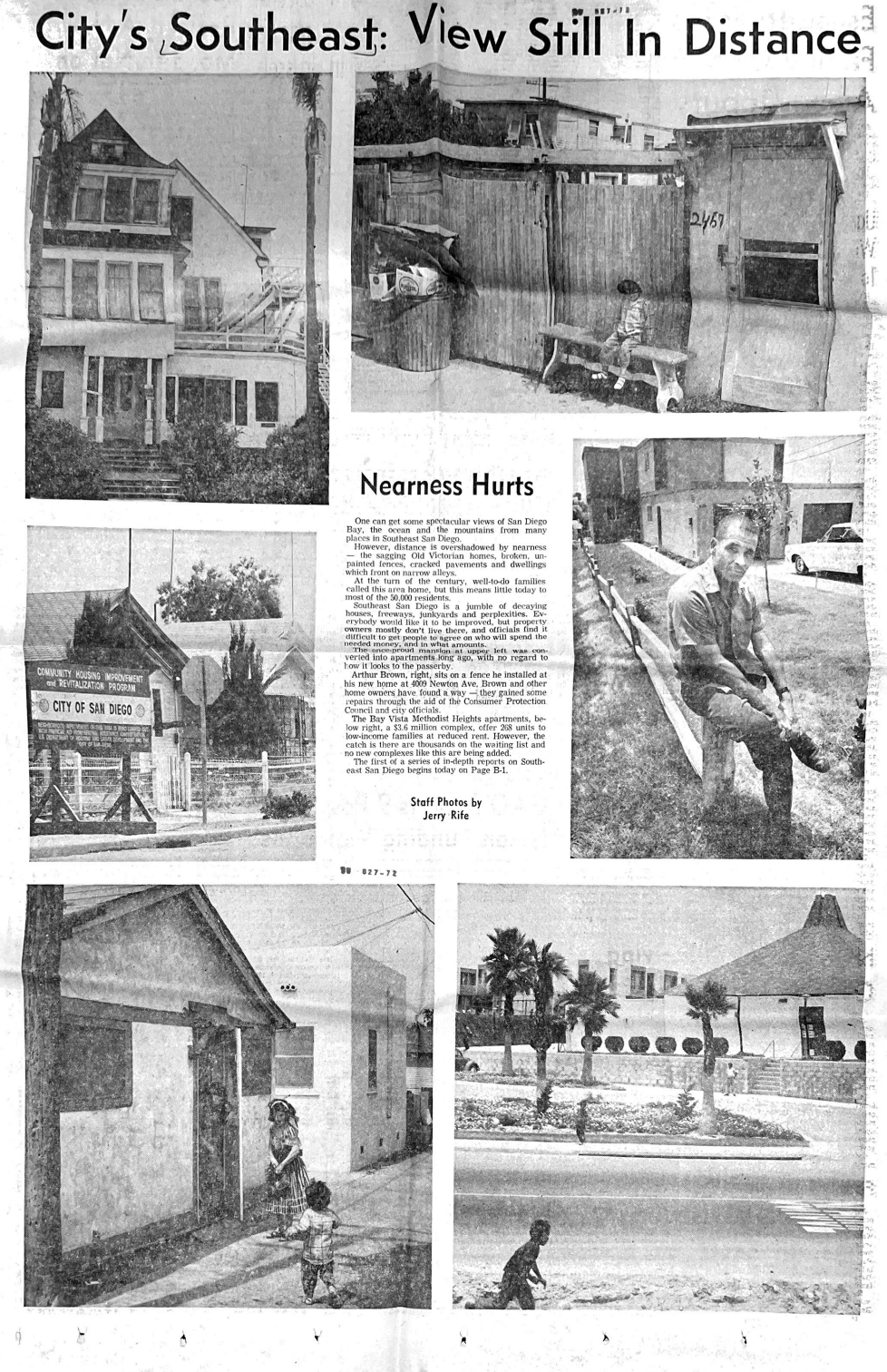
Rife, Jerry. “City’s Southeast: View Still in Distance.” The San Diego Union-Tribune, August 27, 1972, B1. Microfilm, UC San Diego Geisel Library, San Diego, CA.
PART TWO
The plan, the vote, and the clearing
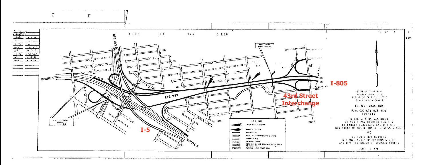
Plans for SR-252. (Route 252. Division of Highways. n.d. Office of the City Clerk, San Diego, CA.)
The origins of SR-252 trace back to a 1954 local study concluding that a new east-west freeway was needed to relieve projected congestion. More than a decade later, on June 29, 1965, the California Highway Commission formally adopted a 1.8-mile corridor linking I-5 and I-805. The route—known as the El Toyon Freeway—ran east from I-5 near Wabash Boulevard along Alpha Street, cutting directly through the heart of Southcrest to meet I-805 near 47th Street. Bridges were planned at 38th, 40th, and 43rd Streets. An interchange was designated for 43rd Street.
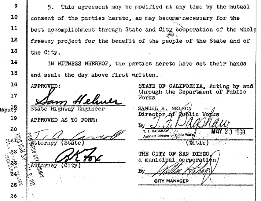
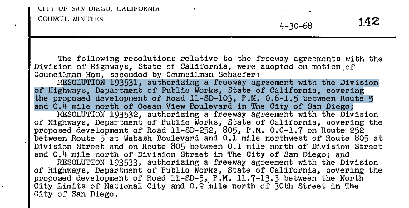
Freeway Agreement. San Diego City Council resolutions, May 20, 1968. Office of the City Clerk, San Diego, CA.
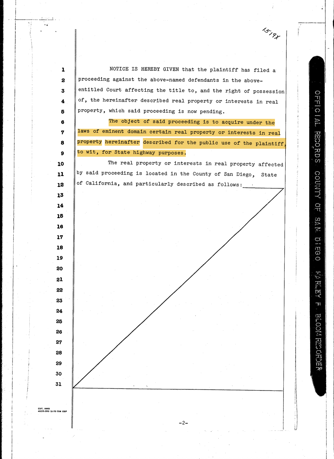
Between 1969 and 1975, the corridor was cleared. Caltrans produced detailed parcel maps identifying approximately 320 properties for seizure—homeowners, businesses, churches, and city-owned land. Where negotiations failed, eminent domain proceedings were filed in the Superior Court of California. Each filing began with the same boilerplate language: “NOTICE IS HEREBY GIVEN that the plaintiff has filed a proceeding…to acquire under the laws of eminent domain certain real property…for State highway purposes.” The land would be taken regardless of opposition.
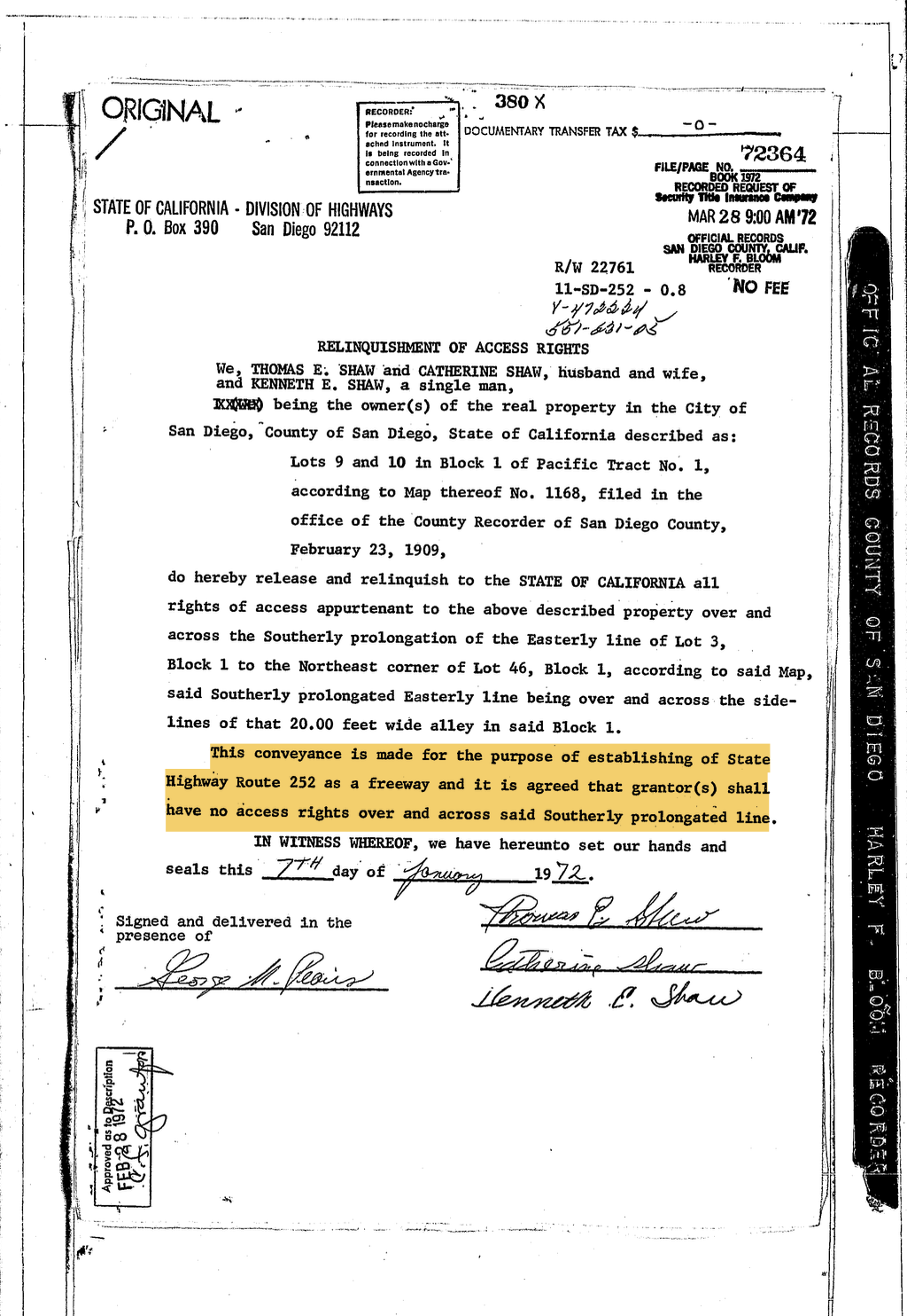
Even homes that weren't demolished were legally severed from their own streets. Some owners were required to sign documents relinquishing access rights to their own property. A home could remain standing but be cut off by legal lines rather than demolition. In the end, 280 homes were demolished to create a 66-acre corridor. The state spent $3.1 million acquiring the right-of-way and $8 million clearing land—all for a freeway that had not yet received final environmental approval.
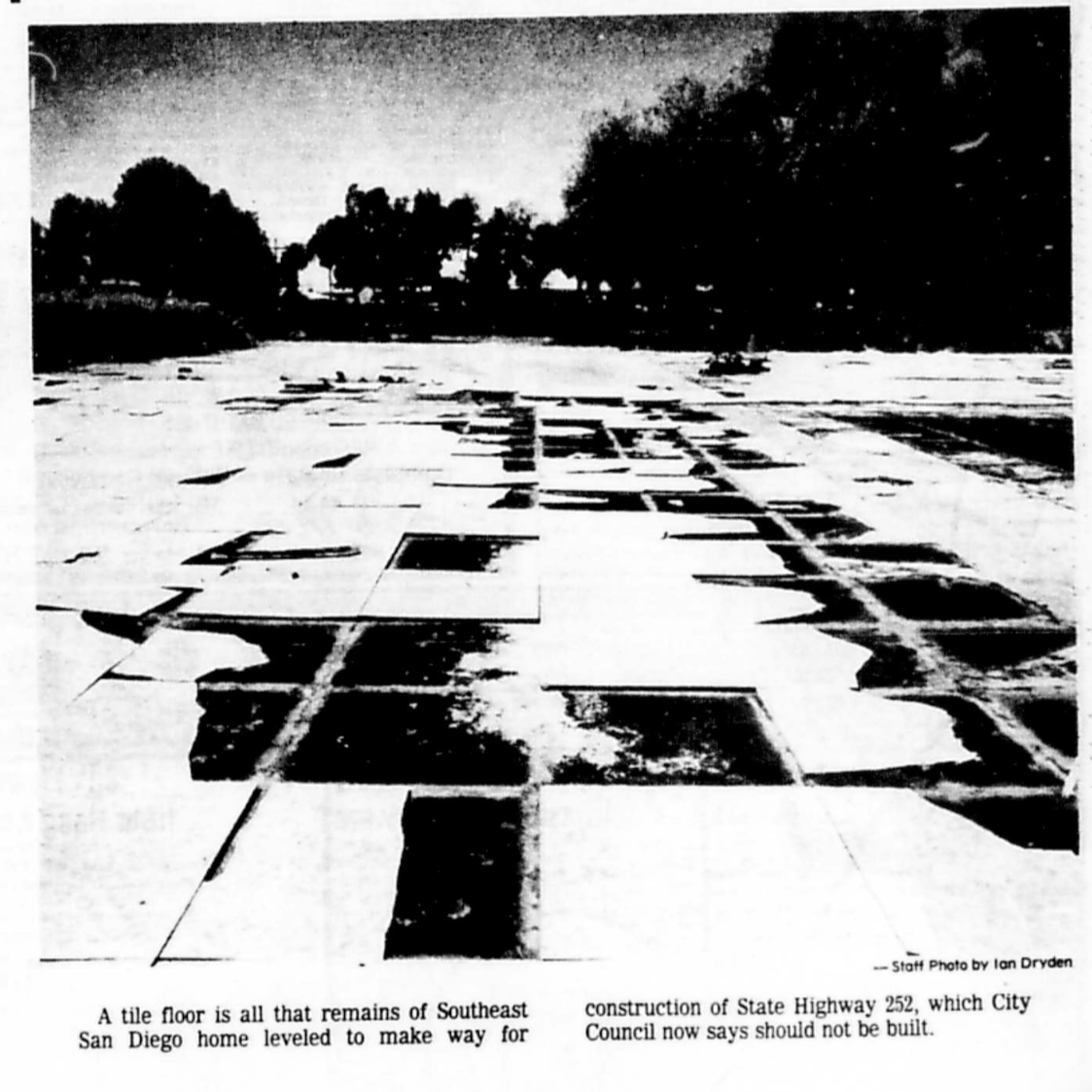
Tile floor remnants of a house demolished for SR-252. (Dryden, Ian. “Southeast San Diego Residents Win Fight: Council Rejects State 252 Freeway.” The San Diego Union-Tribune, April 05, 1978, B1, B4. Microfilm, UC San Diego Geisel Library, San Diego, CA.)
Resolution No. 193532. San Diego City Council meeting minutes, April 30, 1968. Office of the City Clerk, San Diego, CA.
The City Council vote took only minutes. On April 30, 1968, eight White councilmembers unanimously approved Resolution No. 193532. Only Councilmember Floyd Morrow was absent. There was no public outcry, no residents in the gallery. Few in Southcrest even knew the decision had been made. The formal agreement signed shortly after granted the state sweeping powers to seize land, and tucked at the end was a clause allowing either party to modify the agreement by mutual consent.
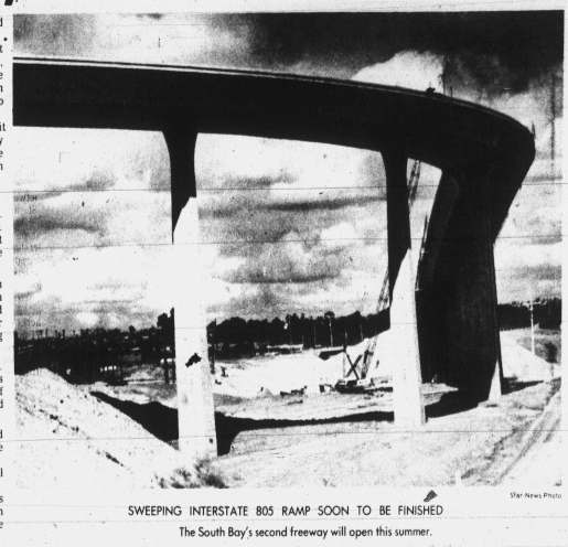
Cross, Linda. “SB traffic bottlenecks may uncork after summer.” Chula Vista Star-News, February 09, 1975, B7. California Digital Newspaper Collection, Chula Vista Star-News (1930-2008), UC Riverside Center for Bibliographical Studies and Research, Riverside, CA.
In 1973, construction began on the 43rd Street Interchange. By 1975, the elevated structure was complete, its ramps jutting westward into empty land. The freeway it was built to serve would never come.
PART THREE
The battle for southcrest
“The opposition against Highway 252 now is an emotional thing... boiling down to a matter of a white man’s freeway vs. a black community.”
Resistance did not begin with a formal organization or a single dramatic moment. It crystallized as demolition crews made the freeway's consequences impossible to ignore. Local churches—including Saint Jude's Parish, Christ Church of San Diego, and Our Lady of the Angels—became early gathering spaces for community votes and strategy sessions. Clergy members were directly involved. The Neighborhood House, rooted in San Diego's Mexican American community, was another organizing hub.
The Black Federation, founded in 1973 by Vernon Sukumu, Dorothy McBrown, Garrett Pryor, and Beverly Wise, became the most prominent coalition force. Its executive board drew from UC San Diego, San Diego State University, the Urban League, the Community Crisis Center, the Model Cities Senior Citizens Program, and the Neighborhood House Association. Together with the Urban League and Neighborhood House, the Federation coordinated community surveys, led protests at City Hall, organized boycotts of National City, and studied freeway alternatives. They reframed SR-252 not as a technical inevitability but as a decision with profound human consequences.
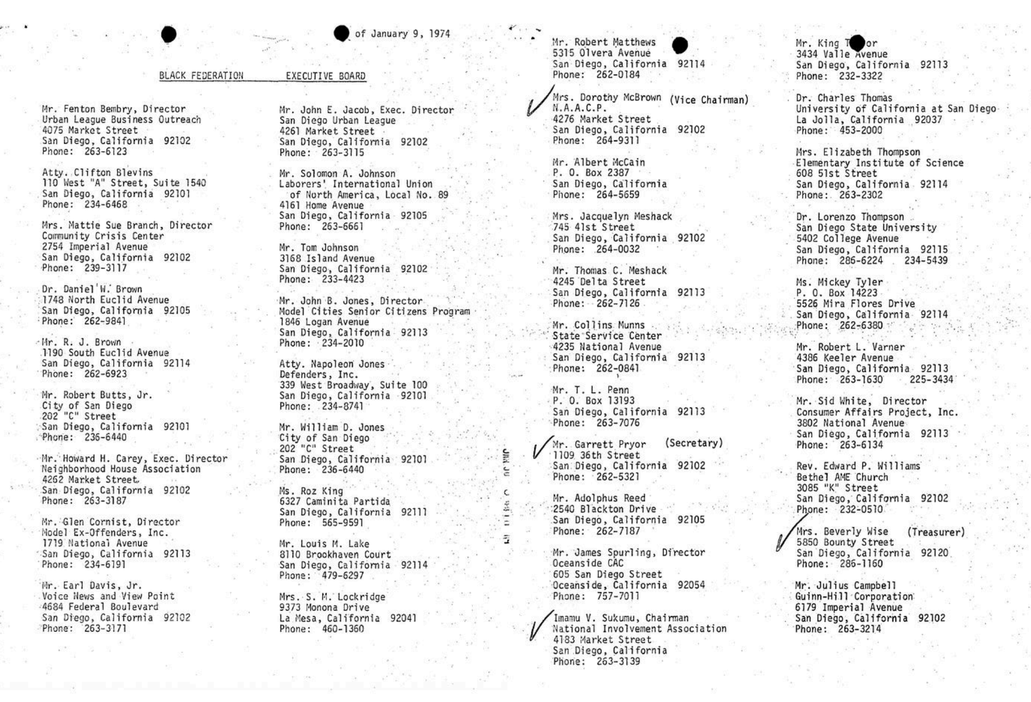
Executive board of the Black Federation. (Black Federation founding documents. July 31, 1973. State of California Office of the Attorney General, Registry of Charitable Trusts, Sacramento, CA.)
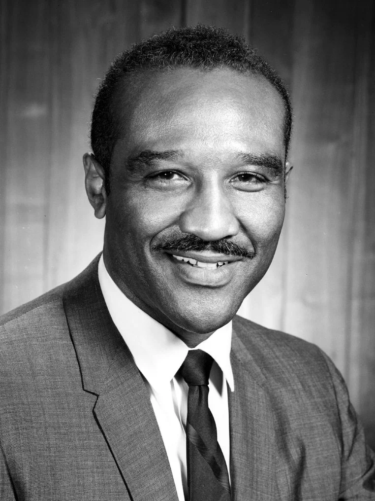
On a city scale, Councilmember Leon Williams (San Diego's first Black council member, elected 1969) became the most important institutional ally. Williams used procedural tactics to slow the freeway's advance: calling for alternative studies, delaying votes, and pushing for environmental review. At a key February 1975 City Council session, he argued the cleared corridor should be redeveloped into “recreational open space, housing and commercial development,” linking the community to the bay, creating jobs, and replacing what had been taken. He did not win that vote, but he helped shift the terms of the debate. That same session, the council voted to continue the freeway agreement over Williams's objections, with only Jess Haro and Maureen O'Connor joining him in opposition.
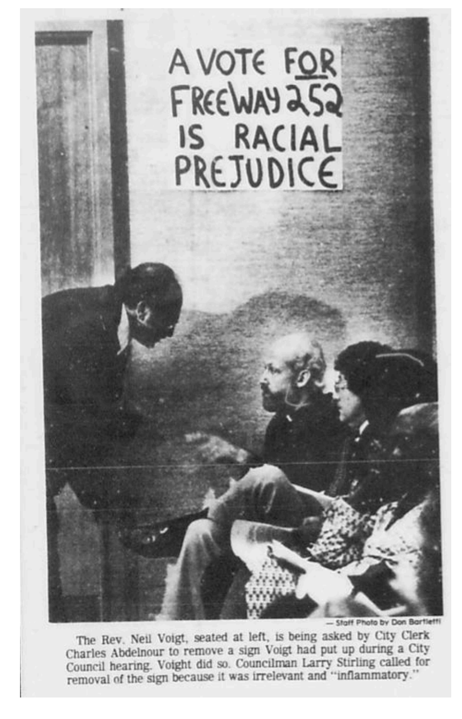
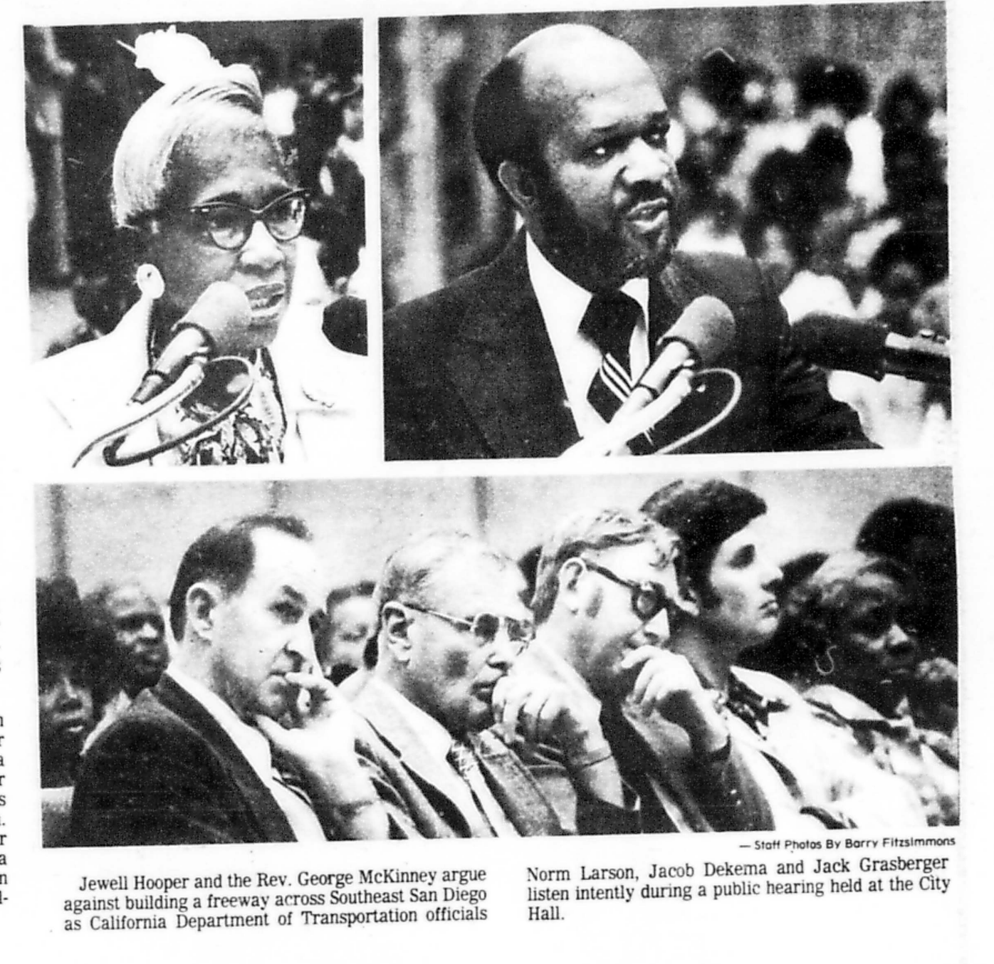
Showley, Roger. “Southeast San Diego Residents Win Fight: Council Rejects State 252 Freeway.” The San Diego Union-Tribune, April 05, 1978, B1, B4. Microfilm, UC San Diego Geisel Library, San Diego, CA.
Carson, Daniel. “Citizens’ Group Opposes Construction of Highway 252.” The San Diego Union-Tribune, March 29, 1978, B1, B4. Microfilm, UC San Diego Geisel Library, San Diego, CA.
Some Alternatives Studied
-
Several major streets in San Diego and National City would be widened to handle increased traffic demand. Cost: $11M for San Diego, $5.2M for National City. Would require removing 240 structures and reimbursing the federal government $4.4M for land already acquired. National City noted it could not afford this option without financial assistance.
-
Add lanes to I-5 (SR-54 to I-15) and SR-94 (I-805 to downtown), with selected arterial improvements. Fewer structures impacted (90 vs. 240), lower city costs — but blocked in part by the Coast Guard, and still required $4.4M in federal reimbursement. Caltrans would carry $11.5M in widening costs.
-
Supported by National City, which feared traffic impacts from cancellation. Opposed by community organizations, Councilmember Williams, and city planners who questioned whether the freeway served any purpose beyond balancing internal freeway-to-freeway traffic between I-5 and I-805.
What all three alternatives shared was a fixation on cars and traffic counts. The people most affected—residents who couldn't afford cars, who relied on streets as neighborhood connectors, whose homes had already been demolished—were largely absent from those calculations.
Key Organizers
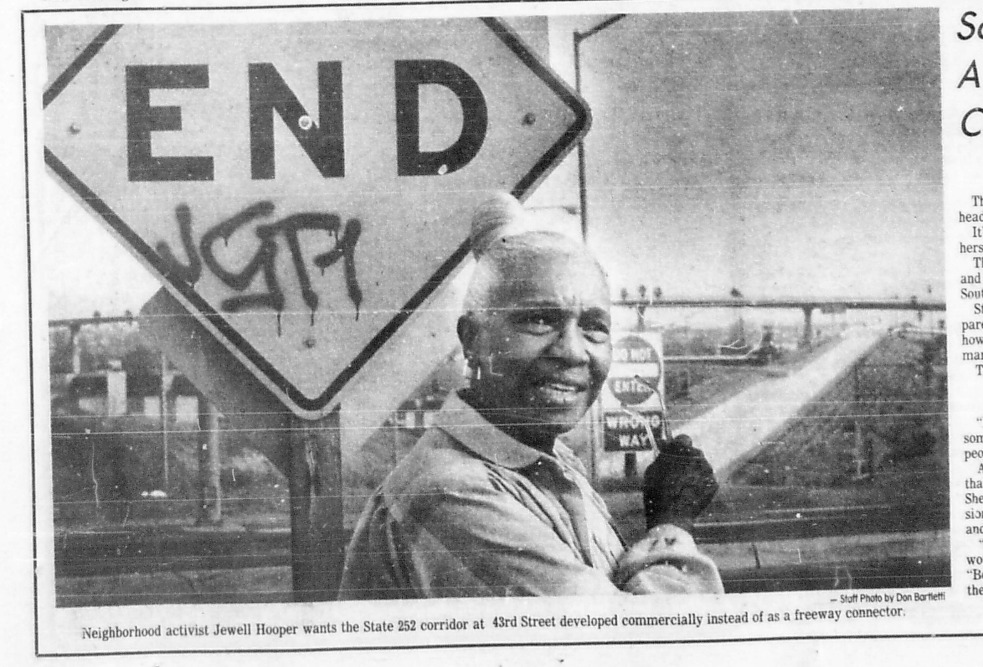
"Perhaps Hooper's greatest asset, said Vernon Sukumu, former head of the Black Federation, is that she is not so sharply aligned with one particular group as to be distrusted or disliked by any of the many political movers and shakers in Southeast. 'You could name a lot of people in the black community and the response from some would be "Ugh, not him or her again." But they don't say that about Jewell…She's truthful without being antagonistic and she brings people together who don't usually come together. I think she's really in tune with most of the black people in her community.'"Kozub, Linda. "Southeast San Diego has a Steadfast, Persuasive, Clear Voice: Jewell Hooper." The San Diego Union-Tribune, February 01, 1981, B1, B5. Microfilm, UC San Diego Geisel Library, San Diego, CA.
Jewell Hooper
Jewell Hooper grew up in Detroit and studied pre-law and math at Howard University, where she had dreamed of sitting on the Supreme Court. After working with the Federal Housing Administration and moving to San Diego in 1957, she became one of the most consequential neighborhood organizers in the city's history.
Activist and Chairwoman of Southeast Development Committee
She served on the county assessment appeals board, chaired the Community Action Partnership Board, and co-chaired the Southeast Development Committee alongside Verna Quinn. According to George Stevens, aide to County Supervisor Jim Bates: “She was instrumental in getting plans for that highway stopped. She organized community meetings, she brought people together, she passed petitions. And instead of just stopping there, she started talking up the idea that the land be used for commercial and residential development.”
Hooper argued that the freeway deepened the isolation of an already cut-off community: “We've been dumped on for so long, we don't protect ourselves…To go from National Avenue to Market Street you have to get on a freeway. We use a freeway like a local street.”
“So the thing to do to give Southeast a much-needed face lift is not to keep talking about it, says Hooper, and not to form committees to investigate it. But to get going and do something. ‘That,’ she vowed, ‘is what I intend to do.’”
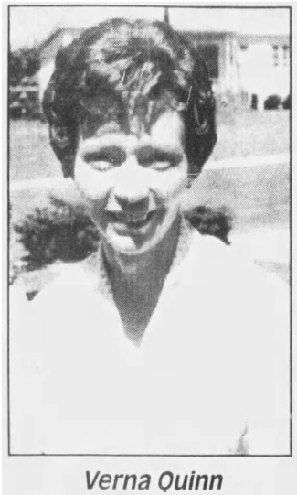
"Verna Quinn...said one of the things she has seen happen in the area is a tremendous loss of population. The area lost more than 10,000 people between the census in 1960 and the one in 1970…'We lost families to the widening of Interstate 15 and to the clearing of the way for 252…The most tremendous impact on Southeast is that freeways tend to isolate people…For example, if you live within the central area of Southeast, to go from north to south you have to get on 805 and come back. It is almost impossible to work your way from north to south within the community. Enormous amounts of money are being spent for social services, but there is never any consideration given to some of the decisions on land use which are what really causes these problems. No one ever looks to see what social and economic impacts these decisions will have.'"Williamson, Jennifer. "White Road Vs. Black Community? State Route 252 is an Emotional Issue for Southeast S.D." The San Diego Union-Tribune, June 05, 1977, B1, B9. Microfilm, UC San Diego Geisel Library, San Diego, CA.
Verna Quinn
Co-Chair of Southeast Development Committee
Verna Quinn co-chaired the Southeast Development Committee alongside Hooper and was, by all accounts, inseparable from her. A white woman from Southern Utah who had been deeply involved in the Civil Rights Movement, Quinn was known for bridging communities that rarely found themselves in the same room. She had at one point been threatened with expulsion from a church for having “too many Black friends.” She and Black nationalist organizer Joshua Von Wolfolk were allies.
Quinn argued: “Enormous amounts of money are being spent for social services, but there is never any consideration given to some of the decisions on land use which are what really causes these problems” The committee organized a boycott of National City and kept pressure on officials through bumper stickers and community meetings.
Verna Quinn Athletic Field in the Encanto neighborhood of Southeastern San Diego is named after her.
“Verna Quinn, a longtime Southeast resident and community activists, said what was on the minds of many of her neighbors who came to Ontario as well as some freeway supporters: ‘This freeway’s caused me more gray hair than anything else.’”
A shifting political landscape — State and City
When Brown took office in January 1975, he quickly redirected California's transportation priorities. Freeway revolts in cities across the country had drawn national attention to the damage highways caused in urban neighborhoods, and Brown responded by deprioritizing new freeway construction in favor of improving existing corridors and expanding urban public transit. The 1970s energy crisis had also cast doubt on a future built entirely around the automobile. Brown's administration gave state-level legitimacy to what Southcrest residents had been arguing for years.
Gianturco's appointment as Caltrans director marked a sharp break from the agency's freeway-first culture. She pushed the department's focus toward community impact, walkability, and equity, questioning whether new freeways were the right answer at all. Her alignment with the community's concerns gave residents and their council allies a rare ally within the state transportation apparatus itself, and helped reframe SR-252 from an engineering inevitability into a policy choice that could be reversed. When invited by Principal Planner Angeles Leira to visit Southcrest and the site of SR-252, Gianturco understood that it was a "freeway to nowhere." She fully supported the decision of the communities.
Leira spent twenty years as the city's principal planner and became one of the most vocal internal critics of SR-252. When she pressed Caltrans engineers about the freeway's purpose and was told it simply balanced traffic between I-5 and I-805, she was outraged: "I just blew up. I told them how dare they do damage like that for something that was an internal function of freeways, and for which there were alternatives." Her position gave institutional weight to what community organizers had argued on moral grounds.
Williams built the council-level opposition over years of procedural delays and alternative proposals. His aide and eventual successor William Jones carried that work forward, arguing that SR-252 displaced homes and businesses without improving access or opportunity. Both testified at the decisive 1986 California Transportation Commission hearing that Southeast San Diego had already been divided by too many freeways, and both were present when the Commission voted unanimously to cancel.
In 1977, the Black Federation, the Urban League, and the Neighborhood House organized a community-wide vote on freeway alternatives. The results were unambiguous. The following year, in April 1978, the San Diego City Council voted to terminate the SR-252 freeway agreement with Caltrans. It was a major victory, but the fight was not over. National City, fearing the traffic the freeway was meant to absorb would fall onto its streets, filed a lawsuit to force Caltrans to honor the original agreement. The dispute would drag on another eight years before reaching its conclusion in Ontario, California in April 1986.
PART FOUR
Ontario, April 24, 1986
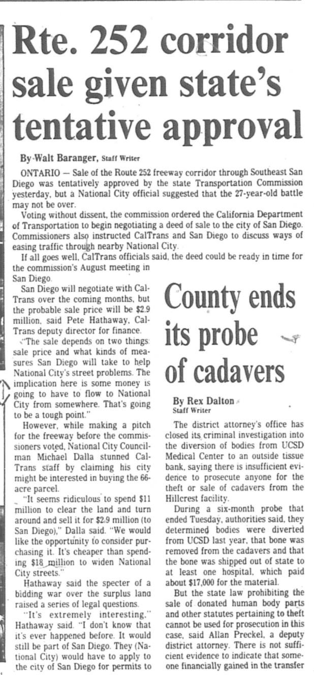
By 1985, the SR-252 dispute had outlasted nearly everyone who started it. The San Diego City Council had canceled the freeway agreement in 1978. National City had sued the state to revive it. Years of attempted compromise had gone nowhere. The California Transportation Commission had the matter on its agenda one final time, and scheduled the hearing not in San Diego, not in National City, but in Ontario, California, roughly 110 miles northeast of Southcrest.
Getting there required organizing. It required money for buses, coordination across a fractured neighborhood, and the kind of sustained commitment that doesn't exist without years of built trust. The community had all of it.
Nearly 200 residents from Southeastern San Diego made the journey. They brought signs. They brought petitions. They filled seats in a room 110 miles from the neighborhood whose future was being decided. It was a demonstration that the community had not exhausted itself after eight years of fighting since the 1978 council vote, and had not been worn down by National City's lawsuit or the long silence of failed negotiations.
The commission's vote was witnessed by 200 Southeast San Diego residents who made the 110-mile drive to Ontario. Most carried signs and petitions calling for the sale, but the sentiment of the commission became evident before any community leaders could speak.
"I am impressed by the city of San Diego's unanimous position. It's obvious to me the city isn't going to sign any freeway agreement."— Commissioner William Bagley
Commissioner Joe Duffel offered a motion authorizing the sale. Only after Commissioner Bruce Nestande offered freeway proponents a chance to "give us overwhelming evidence" did members of the public speak.
Jones presented the core argument: the Southeast area had already been divided by too many freeways. The corridor was not a transportation asset. It was a blighted vacancy that had sat empty for over a decade, used for illegal activity, and surrounded by a neighborhood that needed housing, jobs, and connection, not another concrete barrier. His testimony, supported by documentation of the corridor's condition, was the argument that ultimately persuaded the Commission.
Cleator joined Jones in testifying that Southeast San Diego had borne a disproportionate share of freeway infrastructure. He argued alongside his colleagues that the corridor's future lay in redevelopment, not construction.
Williams had been fighting SR-252 since 1969. By 1986 he was a former council member, but he provided continuity between the original resistance and its conclusion. His presence at Ontario connected seventeen years of organizing to the room where it finally ended.
Dalla spoke on behalf of National City and expressed interest in purchasing the highway corridor — a last attempt to keep the freeway option alive, or at minimum to shape what happened to the land. The commissioners were not persuaded. National City's traffic concerns were real, but the Commission accepted San Diego's commitment to $10 million in road improvements as a workable substitute for the freeway SR-252 was supposed to provide.
Their presence in the room mattered as much as anything said at the microphone. The Commission could see, physically, what it meant for 200 people to travel 110 miles on a weekday to make their case. That kind of turnout doesn't happen for a neighborhood that has given up or been neutralized. It was the visible result of over a decade of organizing by Hooper, Quinn, the Black Federation, the Southeast Development Committee, and everyone who had kept the fight alive through the long years after 1978.
Some Testimonies
The Commission voted unanimously to cancel SR-252 and authorize the sale of the corridor back to San Diego.
San Diego agreed to spend $10 million in road improvements to offset the traffic congestion that SR-252 had been designed to absorb, the compromise that allowed National City to withdraw its lawsuit the following year. The sale of the corridor back to San Diego was authorized at a fraction of its original acquisition cost.
In 1987, National City withdrew its lawsuit at the request of the City of San Diego. SR-252 was formally deleted from state highway plans 22 years after the corridor was first adopted in 1965.
Southeast Economic Development Corporation launches the Southcrest Redevelopment Project. The corridor, vacant for over a decade and cited as a site of illegal activity, becomes the focus of reinvestment.
SR-252 officially deleted from state plans. National City withdraws its lawsuit in exchange for $10M in road improvements.
Corridor rezoned for approximately 3,000 new dwelling units. An elementary school, a neighborhood park, and Southcrest's first major grocery store are built.
The 43rd Street Interchange still stands. The Reconnecting Southeast San Diego and National City Green Corridor initiative opens the possibility of addressing what the 1986 vote could not: the physical structure itself.
What Followed
The Ontario hearing was the end of the legal and political fight. But the interchange remained, and still remains, a structure built for a freeway that was canceled. It is the last piece of SR-252 that Southcrest has yet to reckon with.
Full Timeline
HOLC maps formalize racial exclusion in federal lending policy. Black families are confined to Southcrest and neighboring areas by restrictive covenants and denied mortgages elsewhere.
Black population of Census Tract I0036 grows from 128 (1950) to 2,110 (1960), driven by wartime defense industry work — but housing discrimination funnels new arrivals into already-redlined neighborhoods.
Conducted without public input. The finding quietly sets the groundwork for SR-252 over a decade later.
A 1.8-mile route connecting I-5 and I-805 is formally adopted, cutting directly through Southcrest along Alpha Street.
Resolution No. 193532 passes 8–0. The vote takes minutes. Few residents know it happened. The agreement grants the state sweeping land acquisition powers.
Southeastern San Diego is designated as a target area for urban renewal — even as the city advances a freeway plan that will displace hundreds of families in the same neighborhood.
Elected to represent the district bearing the greatest impact. Immediately begins challenging SR-252 on human and social grounds.
Eminent domain proceedings and grant deed transfers clear a 66-acre corridor without community consultation. The state spends $11.1M total. No final environmental approval exists yet.
The Black Federation is founded the same year. Resistance and construction proceed simultaneously.
Ramps jut into empty land. City Council votes to continue the freeway agreement over Williams's objections, but community organizing intensifies.
The EIR clears the way for full SR-252 construction — but the political landscape is already shifting.
Residents formally and collectively reject the freeway plan. City planner Angeles Leira and new Caltrans director Adriana Gianturco push the conversation toward equity and public voice.
A major victory — but National City, fearing increased traffic, opposes the decision and pushes to revive the plan. The fight continues.
After years of failed negotiations, National City takes legal action. San Diego City Council reaffirms its opposition and urges Caltrans to return the cleared land for redevelopment.
Nearly 200 Southcrest residents travel over 100 miles by bus to a hearing in Ontario, CA. Council members Williams, Jones, and Cleator testify that Southeast San Diego has already been divided by too many freeways. The Commission votes unanimously to cancel. San Diego commits $10M in road improvements to offset National City's traffic concerns.
The vacant corridor becomes the focus of reinvestment. The area is rezoned for new housing, and long-delayed amenities begin to arrive.
Two decades after the corridor was adopted, the freeway is formally erased. An elementary school, a park, and the neighborhood's first major grocery store follow over the next decade.
In partnership with Urban Collaborative Project.